
Kintamani · Adventure
Mount Batur Sunrise Trek: Guides, Prices and What to Expect
A two-hour climb in the dark to the crater of an active volcano, with Agung on the skyline.
By The Bali Guideline Editorial TeamUpdated 16 October 2026
Overview
Mount Batur Sunrise Trek, before you go.
The Mount Batur sunrise trek is a guided climb up a 1,717 m active volcano in Kintamani, about 1 to 1.5 hours north of Ubud. You leave Toya Bungkah at about 4 am, gain roughly 650 m in 1.5 to 2 hours, and watch dawn break over Lake Batur and Mount Agung. It suits anyone fit enough for two hours uphill who can accept a 2 am pickup and a crowd.
Mount Batur (Gunung Batur) is the young cone inside the Batur caldera in Kintamani, and its summit stands at 1,717 m. Its first recorded eruption was in 1804 and its latest in 1999–2000. In 1926 its lava buried the old village of Batur, and the village temple, Pura Ulun Danu Batur, was rebuilt on the caldera rim. In its daily report for 15 October 2026, Indonesia’s volcano agency, PVMBG, kept Batur at Level I (Normal), the lowest of four alert levels, while advising visitors not to linger or camp in the active crater and to stay away from its gas vents.
The climb is short but steep. Most groups leave the car park near Toya Bungkah, at about 1,050 m, at around 4 am with headlamps and a local guide, and reach the top in 1.5 to 2 hours. BKSDA Bali, the conservation agency that runs the mountain as a nature park, grades it 1 to 2 on a five-step scale, easy to moderate. There are no exposed drops, but the volcanic grit slides underfoot, especially on the way down. At the top, warung huts sell drinks, guides steam eggs and bananas in the vents, and the sun rises between about 5:50 am in November and 6:30 am in July.
You will not climb alone. The Mount Batur trekking guides’ association, PPPGB, holds what Lonely Planet calls a monopoly on guided ascents, and every tour operator uses its guides. BKSDA backs the arrangement: the head of its Kintamani unit said in 2023 that visitors should be accompanied by a guide, and the agency calls local villagers the mountain’s official guides. Foreign climbers also owe BKSDA an entrance fee of IDR 100,000, which most packages include.
Expect company. BKSDA counted 73,619 climbers in 2025, about 200 a day on average and more than 300 a day in June, and a government carrying-capacity study puts the summit’s limit at 500 people. Peak mornings bring a queue of headlamps on the last ridge, dust and drink sellers. Access has wobbled before. In 2023 Bali’s then governor announced a ban on climbing the island’s mountains, but it was never enforced. BKSDA does close the park for Nyepi, as it did from 18 to 20 March 2026, and now and then for village ceremonies, as on 14 and 15 October 2023. In August 2026 a fire blamed on a cigarette butt burned two hectares of its forest.
Is it worth it? On a clear dry-season morning, yes. Watching the light come up over the caldera, with Abang and Agung in silhouette and the crater steaming beside you, repays the 2 am alarm. If you hate early starts or crowds, the Pinggan viewpoint on the north rim or a jeep tour gives you the same sky without the climb.
- Opening hours
- Treks start 3:30–4 am; Ubud pickups about 2 am (checked Oct 2026)
- Ticket
- Tours IDR 300,000–700,000 a person, incl. guide and entry (checked Oct 2026)
- Time needed
- 4–5 hours on the mountain; 8–10 hours from an Ubud pickup
- Best time
- Clearest June–September; quieter in April, May and October
- Dress code
- Warm layers, beanie and grippy shoes; no sarong needed
- Location
- Toya Bungkah, Kintamani, 43 km north of Ubud (1–1.5 hours)
Jl. Raya Toya Bungkah, Kintamani, Bangli Regency, Bali, Indonesia
Open in Google MapsWhat to See
What to see at Mount Batur Sunrise Trek.
- 01
The climb from Toya Bungkah
Most treks start at the car park just south-west of Toya Bungkah village. After a briefing and a headlamp check you walk up sandy tracks across the lower slopes, then onto open volcanic grit, with stops every 20 to 30 minutes. About 1.5 hours brings you to a warung on the lower southern rim. The stretch above it, past a small shrine, is the steepest. Allow about an hour for the descent, which is harder on the knees.
- 02
Sunrise from the summit
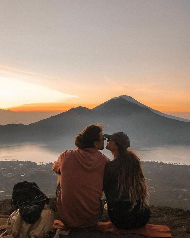
The sky starts to glow about 20 minutes before sunrise, which comes between about 5:50 am in November and 6:30 am in July. The sun comes up over the eastern rim of the caldera, and to its right Mount Abang, the rim’s high point at 2,151 m, and the cone of Mount Agung stand in silhouette above Lake Batur. Cloud in the caldera can hide everything, most often from December to March.
- 03
Breakfast from the steam vents
Near the summit, steam escapes from cracks in the rock, and guides use it to cook eggs and bananas, usually served with bread and hot tea or coffee from a summit warung. Most tours include breakfast; Lonely Planet lists it at IDR 50,000 if yours does not. Monkeys wait on the rim for scraps and snatch unattended snacks and bottles, so keep food zipped inside your bag and do not feed them.
- 04
The crater rim route
If you still have energy after sunrise, ask for the crater route. From the lower warung the path follows the rim east, then climbs steeply to an upper warung near the highest point. The next 500 m along the crater edge is narrow and steep enough that you may need your hands, and it passes steaming ground. It adds about an hour. PVMBG advises visitors not to linger near the crater’s gas vents.
- 05
Other trailheads
Toya Bungkah is the busiest start, not the only one. Traveloka describes a steeper, quieter route from Pura Jati, about 2 to 2.5 hours to the top, and a longer path from Serongga through forest and farmland with few markers. Lonely Planet also describes a car park on the north-east slope, reached by a track off the Songan road, from which the summit is about 45 minutes on foot. Ask your operator which start it uses.
- 06
The sunrise jeep tour
For non-hikers, 4WD jeeps drive up sandy tracks to a sunrise point on the lower slopes, well below the summit, and afterwards cross the black lava fields from the eruptions of 1963–64 and later. You trade the climb for engine noise, dust and a line of other jeeps. Batur Natural Hot Spring charges IDR 1,350,000 for two people on a private sunrise jeep, with fees and breakfast, and more with lava stops (checked Oct 2026).
- 07
Hot springs afterwards
Toya Bungkah’s hot springs sit a few minutes’ drive from the trailhead, which is why you pack swimwear. Village-run Batur Natural Hot Spring charges foreign adults IDR 200,000 and children IDR 100,000, with towel and locker, daily 7 am to 7 pm (checked Oct 2026). Toya Devasya nearby has eight natural pools and an Olympic-size pool. Both fill from mid-morning as trek groups come down, so go straight from the trail.
Seasons
Best time to visit Mount Batur Sunrise Trek.
Come in the dry season. Kintamani gets about 65 mm of rain on five days in August, against more than 400 mm on about 20 days in December and January. June to September brings the clearest sunrises and the firmest footing. From December to March, cloud often fills the caldera and wet grit turns slick. April, May and October are good compromises with fewer climbers.
Crowds follow the holidays. BKSDA’s 2025 count peaked in June with 9,378 climbers, followed by August and May, and dropped below 2,500 in January and February. Most climbers are Indonesian, so school holidays and long weekends fill the trail, as do Christmas and New Year. Weekdays are calmer.
Check the calendar too. BKSDA closes the park around Nyepi, from 18 to 20 March in 2026; Nyepi next falls on 8 March 2027. Village ceremonies can shut the trail for a day or two, as in October 2023, so ask your operator the day before. Sunrise is earliest in November, about 5:50 am, and latest in July, about 6:30 am.
Getting There
How to get to Mount Batur Sunrise Trek.
| From | Time | How |
|---|---|---|
| Ubud | 1–1.5 hours | About 43 km north by car via Tegallalang and Penelokan, then down the hairpins to the lake. Trek pickups leave Ubud at about 2 am. |
| Seminyak, Canggu or Kuta | 2–2.5 hours | About 74 km by car on empty night roads. Trek pickups leave at about 1:15 am, so consider a night in Ubud before the trek. |
| Sanur | 1.5–2 hours | About 64 km by car north through Gianyar. Trek pickups leave at about 1:30 am. |
| Uluwatu, Jimbaran or Nusa Dua | 2.5–3 hours | About 83–94 km by car. Pickups leave at about 1 am; a night in Ubud or by the lake makes the morning far easier. |
| Bali airport (DPS) | 2–3 hours | About 76 km by car. Do not plan the trek on arrival day; sleep in Ubud or Kintamani and climb the next morning. |
| Penelokan (Kintamani rim) | 15–20 min | About 8 km down the hairpin road through Kedisan and along the lake. Stay on the rim or by the lake and you can sleep until about 3 am. |
| Lovina and the north coast | 1.5–2 hours | About 72 km by car via Singaraja, over the north rim at Penulisan. |
Getting around Mount Batur Sunrise Trek
Almost everyone comes on a tour with pickup, because there is no public transport at 3 am. Your driver drops you at the trek car park near Toya Bungkah, where guides meet their groups, register climbers and hand out headlamps and poles. Use the toilets at the basecamp before you start. If you drive yourself, the road from Penelokan drops about 400 m through hairpins to Kedisan, then runs about 5 km north along the shore.
Skip the scooter. A 2 am ride from the south means fog, unlit bends, sand trucks and cold, and you ride back tired after the descent. App rides are hard to find in Kintamani before dawn, and few drivers wait for a return fare, so keep your tour driver or book a car for both legs.
On the mountain you walk every step up and down. One guide usually leads up to five people, and slower groups simply stop more often. There is no shade after sunrise, so the descent in the 8 am sun is hot and dusty; keep water for the way down.
Know Before You Go
Mount Batur Sunrise Trek tips that save time and trouble.
- 01Get the inclusions in writing: guide, BKSDA entry fee, breakfast, headlamp, pickup, and whether the hot spring is extra.
- 02Pack for 8–18°C and wind at the top: fleece, windproof jacket, beanie and gloves, plus a dry shirt and socks to change into.
- 03Wear trail shoes or boots with real grip. Poles help on the sliding grit of the descent, and many tours lend them.
- 04Check Batur’s alert level on MAGMA Indonesia (magma.esdm.go.id) the day before. On 15 October 2026 it was Level I (Normal).
- 05Do not smoke or drop litter. A cigarette butt is the suspected cause of a two-hectare fire on the slopes in August 2026.
- 06Keep snacks zipped inside your bag; monkeys on the rim grab food and drinks.
- 07Carry small cash for summit drinks and donations. Bangli’s Kintamani area fee, IDR 50,000 for foreigners, is collected 8 am–5 pm at road posts.
- 08Flying a drone in the park needs a BKSDA permit, and its 2026 tariff lists IDR 2 million for drone use.
- 09Sleep in Toya Bungkah or Songan and you meet your guide at about 3:30 am instead of a 2 am pickup.
FAQ
Mount Batur Sunrise Trek questions, answered.
Can you hike Mount Batur without a guide?
Not realistically. BKSDA Bali, which manages the mountain as a nature park, says climbers should go with a guide, and the guides’ association, PPPGB, has long been known for confronting people who set off alone. Every tour includes one of its guides. Even if you find another path, you risk an argument on the trail, a fee anyway, and a fall on loose grit in the dark.
How much does the Mount Batur sunrise trek cost?
One lakeside operator lists private treks at IDR 700,000 for one person, down to IDR 300,000 each for five, with pickup, guide, entry fee and breakfast (checked Oct 2026). A GetYourGuide sunrise tour started at about IDR 500,000 in early 2026. Lonely Planet lists PPPGB’s own rates from IDR 400,000 a person. Jeep tours cost more, and the hot springs are usually extra.
Is there an entrance fee for Mount Batur?
Yes. Foreign climbers pay BKSDA Bali IDR 100,000, and Indonesians IDR 10,000, or IDR 15,000 on holidays, according to the agency’s 2025 figures. Bangli regency also collects an IDR 50,000 Kintamani area fee from foreigners from 8 am to 5 pm, and Bali’s IDR 150,000 tourist levy applies once per trip. Ask which of these your tour covers.
How hard is the Mount Batur hike?
Easy to moderate. BKSDA Bali grades it 1 to 2 out of 5: about 650 m of climbing in 1.5 to 2 hours on sandy volcanic grit, with no exposed drops. The last section below the rim is steep, and the descent is harder than the climb because the grit slides. Anyone who can walk uphill for two hours with breaks can do it.
How long does the Mount Batur trek take?
About 4 to 5 hours on the mountain: 1.5 to 2 hours up, an hour at the top for sunrise and breakfast, and about an hour down. The crater route adds an hour. From an Ubud pickup at 2 am you are back by about 10 to 11 am, or early afternoon with the hot springs.
What time is pickup for the Mount Batur sunrise trek?
About 2 am from Ubud, 1:30 am from Sanur, 1:15 am from Seminyak, Canggu and Kuta, and 1 am from Nusa Dua, Jimbaran or Uluwatu. Guides start walking between 3:30 and 4 am to reach the top before sunrise. If you sleep in Toya Bungkah or Songan, you meet your guide at about 3:30 am instead.
Is the Mount Batur jeep sunrise tour worth it?
Yes, for children, bad knees or anyone who will not climb. Jeeps reach a sunrise point on the lower slopes, below the summit, then drive across the black lava fields. You lose the crater and the sense of achievement, and share the view with many other jeeps. One lakeside operator charges IDR 1,350,000 for two people on a private jeep (checked Oct 2026).
Is Mount Batur safe to climb?
Usually. On 15 October 2026, PVMBG kept Batur at Level I (Normal), its lowest alert level, but advised visitors not to linger or camp in the active crater and to keep away from gas vents. The everyday risks are slips on loose grit in the dark, cold wind at the top and the 2 am drive on mountain roads.
How cold is it at the top of Mount Batur?
Cold enough for a fleece and beanie. Guides and visitor reports put the pre-dawn summit anywhere between about 8°C and 18°C, and the wind on the rim makes it feel colder, especially after you stop sweating. It warms quickly once the sun is up, so wear layers you can strip off for the descent.
When is the best time to climb Mount Batur?
June to September, the heart of the dry season, gives the best chance of a clear sunrise and a dry trail. April, May and October are quieter with slightly more cloud. From December to March, rain and cloud often hide the view. The park closes around Nyepi, next on 8 March 2027, and sometimes for village ceremonies.
Is Mount Batur closed?
Not as far as official notices showed on 16 October 2026. Bali’s 2023 plan to ban mountain climbing was never enforced, and the trail stayed open after the August 2026 forest fire. BKSDA Bali closes the park for a few days around Nyepi, as it did from 18 to 20 March 2026, and occasionally for village ceremonies, so confirm with your operator the day before.
Nearby
Where to go after Mount Batur Sunrise Trek.
Places close by that fit into the same trip, with honest travel times.
About 5 min by car (1 km)
Batur Natural Hot Spring
Lakeside pools of volcanic hot water in Toya Bungkah, the obvious stop after the descent.
15–20 min by car (8 km)
Penelokan caldera rim and Batur Geopark Museum
The whole caldera from the rim road, plus a museum that explains how it formed (closed Fridays).
25–30 min by car (12 km)
Pura Ulun Danu Batur
Bali’s supreme water temple, moved to the rim after the 1926 eruption buried its first site.
45–60 min by car (26 km)
Besakih Temple
Bali’s mother temple on the slopes of Mount Agung, south-east of the caldera.
Visitor guide50–60 min by car (25 km)
Tirta Empul
A 10th-century spring temple where you can join the purification ritual on the way back to Ubud.
Visitor guideAbout 1 hour by car (32 km)
Tegallalang Rice Terrace
Ubud’s famous terraces, right on the road south from Kintamani.
Visitor guide
More in Kintamani
Plan the rest of your time in Kintamani.


How we researched this
Sources and fact checks.
Prices, opening hours, show times and travel times in this Mount Batur Sunrise Trek guide were checked against official sites, government tourism pages and recent reporting on 16 October 2026. Where sources disagreed, we give the official figure and say so. Rankings are our editorial judgment, set out in our editorial policy.
We re-check the guide at least every three months and whenever we hear about a change. Spotted something out of date? Tell us.
Show all 32 sources ↓Hide sources ↑
- magma.esdm.go.id/v1/gunung-api/tingkat-aktivitas%20(Batur%20list…
- magma.esdm.go.id/v1/gunung-api/laporan%20(PVMBG%20Batur%20daily%…
- ksda-bali.go.id/artikel/grading-pendakian-gunung-batur-tetap-ra…
- denpost.id/bali/105516540325/2025-pendaki-gunung-batur-tem…
- bali.antaranews.com/berita/400839/bksda-bali-tutup-sementara-empat-…
- rri.co.id/en/tourism/2255693/bali-nature-tourism-parks-cl…
- bali.antaranews.com/berita/399066/bksda-bali-perbaiki-administrasi-…
- detik.com/bali/berita/d-6973729/ada-upacara-adat-pendakia…
- thebalisun.com/bali-axes-ban-on-tourist-access-to-sacred-mount…
- adventure.com/bali-hiking-ban-mount-batur-indonesia
- bali.live/p/two-hectares-of-protected-forest-burn-on-moun…
- bali.antaranews.com/berita/360829/pemkab-bangli-tertibkan-aturan-pe…
- detik.com/bali/berita/d-8413924/viral-wisatawan-diminta-r…
- bali.antaranews.com/berita/396266/pemkab-bangli-awasi-ketat-kintama…
- goasia.cc/en/news/bali-kintamani-entry-fee-online-system-…
- lovebali.baliprov.go.id/%20(IDR%20150,000%20tourist%20levy)
- lonelyplanet.fr/destinations/asie/indonesie/bali/que-faire/gunu…
- gunungbagging.com/batur/%20(trailhead%20elevations,%20rim%20route…
- baliholidaysecrets.com/mount-batur-sunrise-trek/%20(pickup%20times%20b…
- baturnaturalhotspring.com/mount-batur-private-sunrise-trekking-tour/%20(p…
- baturnaturalhotspring.com/sunrise-jeep-adventure/%20(jeep%20prices)
- baturnaturalhotspring.com/natural-hot-spring/%20(hot%20spring%20prices%20…
- toyadevasya.com/home-hotspring
- seeksophie.com/magazine/a/things-to-know-before-you-hike-mt-ba…
- theworldtravelguy.com/mount-batur-bali-hike-sunrise-trekking-at-gunun…
- traveloka.com/id-id/explore/destination/mount-batur-trekking-…
- guidegunungbatur.com/informasi-pendakian-gunung-batur-bali/%20(summi…
- weather2travel.com/indonesia/kintamani/climate
- en.wikipedia.org/wiki/Mount_Batur%20(geo:%20summit%20coordinates…
- https://api.sunrise-sunset.org (sunrise times at the summit by month)
- https://router.project-osrm.org (road distances to Toya Bungkah)
- thebaliguideline.com/blog/must-things-to-do-in-bali%20(hero%20photo%…