
Sidemen · Adventure
Mount Agung Trek: Routes, Rules and What It Really Takes
Bali’s highest and holiest volcano, climbed overnight with a local guide.
By The Bali Guideline Editorial TeamUpdated 11 November 2026
Overview
Mount Agung Trek, before you go.
The Mount Agung trek is an overnight guided climb of Bali’s highest volcano, 3,031 m, in Karangasem, about 35 to 50 minutes from Sidemen. The short route from Pura Pasar Agung reaches the crater rim in 3 to 4 hours, and the Besakih route reaches the true summit in about 6. It suits fit hikers with a head for heights, not first-time trekkers.
Mount Agung (Gunung Agung) is the volcano every Balinese temple faces. Modern surveys put its summit at 3,031 m, while PVMBG, Indonesia’s volcano agency, and older maps still give 3,142 m. Its 1963 eruption killed an estimated 1,100 to 1,500 people, and lava stopped meters short of Besakih, the mother temple on its southwest slope. In September 2017 about 122,500 people were evacuated from a 12 km exclusion zone. Eruptions in November that year closed Bali’s airport, and smaller ones followed until 2019 and in 2022. In its daily report for 10 November 2026, PVMBG kept Agung at Level I (Normal), the lowest of four alert levels, but told climbers not to linger near the crater, not to stay there in cloud or rain, not to camp near it and not to go down into it.
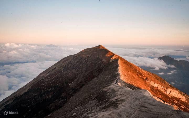
Two routes matter. From Pura Pasar Agung in Sebudi, at about 1,600 m, you climb 297 steps to the temple, then a steep forest path and bare rock to the south crater rim at roughly 2,860 to 2,900 m, about 150 m below the top. From Besakih, at about 1,100 to 1,200 m, a longer and steeper path climbs through forest and loose gravel to the true summit, with a narrow ridge for the last 15 to 20 minutes. Both are walked in the dark to reach the top for sunrise.
The rules tightened in 2025. On 10 January 2025, Bali’s forestry and environment office made a local guide compulsory and told climbers not to go up in heavy rain or storms. A week earlier, rescuers had found the body of a 31-year-old South Korean climber who had set off alone on the Pasar Agung route. He had fallen about 100 m below the trail at 2,200 m. Guides also lead the offerings at the temple before you start.
The mountain closes for ceremonies, sometimes for weeks. Climbing stopped from 1 October to 30 November 2024 for rites at Pura Pasar Agung, and from 28 March to 24 April 2026 for Ida Bhatara Turun Kabeh at Besakih. Bali’s 2023 plan to ban tourists from its mountains was never enforced.
Is it worth it? For strong hikers on a clear dry-season night, yes. You watch the sun come up over Lombok’s Rinjani with Batur and the whole island below you, a view Bali’s easier sunrise climbs cannot match. It is far harder than Batur: steep, relentless and hard on the knees going down. If you have not hiked at night on loose rock before, start with Batur.
- Opening hours
- Night climbs from about midnight or 2 AM, by route (checked Nov 2026)
- Ticket
- Guided treks about IDR 550,000–2,200,000 a person (checked Nov 2026)
- Time needed
- 6–8 hours (Pasar Agung) or 10–14 hours (Besakih) on the mountain
- Best time
- Dry season, about May–October; closed for big ceremonies
- Dress code
- Warm layers, windproof jacket, gloves, boots with grip, headlamp
- Location
- Sebudi (Pasar Agung) or Besakih, 35–50 min north of Sidemen
Today at Mount Agung Trek
- Daylight
- to
- Hours of light
- 12 hr 28 min of light
Checking the weather in Amed…
Times for this spot, in Bali time (WITA).
Pura Pasar Agung trailhead, Sebudi, Selat, Karangasem Regency, Bali, Indonesia
Open in Google MapsWhat to See
What to see at Mount Agung Trek.
- 01
The Pasar Agung route to the crater rim
The shorter route starts at the parking lot below Pura Pasar Agung, at about 1,600 m. After 297 steps to the temple and a prayer with your guide, the path climbs steeply through forest full of roots, past a small concrete dam, then onto bare volcanic rock where you use your hands. Allow 3 to 4 hours up and about the same down. The rim looks into a crater about 700 m across.
- 02
The Besakih route to the true summit
From the temple complex at about 1,100 to 1,200 m, the trail passes Pura Pengubengan, enters forest at about 1,300 m and goes almost straight uphill on slippery roots and gravel. Expect about 6 hours up, with rests, and a round trip of 10 to 14 hours. Above 2,600 m one short stretch runs beside a drop, and the final ridge to the summit is often less than a meter wide.
- 03
Sunrise from the top
Climbs are timed to reach the rim or summit before sunrise, which in this part of Bali comes between about 5:45 AM in November and 6:35 AM in July. On a clear morning you see Rinjani on Lombok to the east, Batur and its lake to the northwest, and Nusa Penida and the south coast far below.
- 04
The crossover to the summit from Pasar Agung
At about 2,425 m on the Pasar Agung route, a faint path turns off toward the true summit and joins the Besakih trail near the top. There is no clear trail, only painted marks on the rock, and it needs scrambling. Some guides offer it as a “highest peak via Pasar Agung” trek with an earlier start. Ask for it only if you are a confident scrambler and the weather is settled.
- 05
Offerings and temple rites
Agung is the seat of the gods for Balinese Hindus, and every climb starts with a guide placing offerings at the temple at the trailhead and asking for a safe return. Guides make offerings again at the top. You are welcome to light incense and join quietly. Do not leave trash, shout, or climb on shrines, and follow your guide’s lead on where to sit.
- 06
The descent
Most people find the way down harder than the climb. In daylight you see how steep the slope is, the gravel slides underfoot and your knees take the full load for 3 to 4 hours from the rim, longer from the summit. Poles help. Groups usually reach the trailhead from late morning to early afternoon, so keep some water and food for the last hours.
Seasons
Best time to visit Mount Agung Trek.
Climb in the dry season, roughly May to October, when the rock is dry and dawn is most often clear. Bali’s wet season runs from November to March, and Agung itself pulls rain onto its southern slopes. From December to March, cloud and rain often hide the view, and since January 2025 climbing in heavy rain or storms has been banned.
Dry does not mean calm. Gunung Bagging’s route notes describe trade winds gusting up to about 100 km/h on the summit ridge from June to September, strong enough to force groups to turn back. Pick a night with a settled forecast, check BMKG weather the day before, and check Agung’s alert level on MAGMA Indonesia (magma.esdm.go.id).
Ceremonies close the mountain. Besakih’s annual Ida Bhatara Turun Kabeh, usually in March or April, shut all routes from 28 March to 24 April 2026, and ceremonies at Pura Pasar Agung closed it from 1 October to 30 November 2024. Nyepi falls on 8 March 2027. Ask your guide a few days before you go whether the trail is open.
Coming between November and March? Read our Bali rainy season guide →
Getting There
How to get to Mount Agung Trek.
| From | Time | How |
|---|---|---|
| Sidemen | 35–50 min | About 20 km by car north through Selat to the parking lot below Pura Pasar Agung. Besakih is 18–24 km, 30–45 minutes, the other way round. |
| Ubud | 1.5–2 hours | About 45 km to Besakih or 55 km to Pasar Agung by car via Klungkung. Night pickups leave at about 9 PM for the summit route and 11 PM for the rim. |
| Sanur | 1.5–2 hours | About 50–60 km by car along the coast bypass, then north through Klungkung. |
| Seminyak or Canggu | 2–2.5 hours | About 65–75 km by car on empty night roads. Consider a night in Sidemen first so the pickup is closer to midnight. |
| Bali airport (DPS) | 2–2.5 hours | About 65–75 km by car. Do not climb on arrival day. Sleep in Sidemen or near Besakih and go the next night. |
| Amed or Candidasa | 45–75 min | About 26 km from Candidasa or 40 km from Amed by car to Pasar Agung via Rendang and Selat. |
Getting around Mount Agung Trek
Almost everyone comes on a guided package with a driver, because there is no public transport at night and app rides do not wait in Sebudi or Besakih. Your driver drops you at the trailhead parking lot, where guides meet their groups, check headlamps and lead the offerings. Book the car for the round trip, since you will not find a ride down.
Do not ride a scooter up for a night start. The roads above Selat and Besakih are steep, narrow and unlit, often wet or foggy, and you ride back exhausted after 8 to 14 hours on your feet. The South Korean climber found in January 2025 had come up alone by rented motorbike and left it at Pura Pasar Agung.
On the mountain you walk and scramble every step. There is no shelter on the upper slopes and no water source on either route, so your guide sets the pace and the turnaround time. Turn back when your guide says so, as summit wind and cloud can change within minutes.
Tickets & Tours
Mount Agung Trek tours on Klook.
You can visit on your own with the details above. If you would rather have the driver, guide or entry sorted, these Klook tours include Mount Agung Trek. Prices, pick-up areas and what is included vary, so check the listing before you book.
Affiliate links: we may earn a commission if you book, at no extra cost to you. Affiliate disclosure
Know Before You Go
Mount Agung Trek tips that save time and trouble.
- 01Book a licensed local guide. Since January 2025 you may not climb Agung without one.
- 02Get the inclusions in writing: guide, transport, breakfast, headlamp, and whether it is the rim or the true summit.
- 03Pack for cold and wind: fleece, windproof jacket, beanie, gloves and a dry shirt for the top.
- 04Carry snacks and at least 2 liters of water per person. There is no water on the mountain.
- 05Wear hiking boots or trail shoes with real grip, and bring poles for the descent.
- 06Take a headlamp with fresh batteries, plus a spare light. The forest sections are pitch dark.
- 07Do not climb if PVMBG raises Agung above Level I or if it has rained hard that day.
- 08Respect the closures. Temple elders have complained about foreigners climbing during ceremonies.
- 09Check that your travel insurance covers trekking at 3,000 m. Rescues here take many hours.
- 10Sleep in Sidemen the night before to cut the drive to under an hour.
FAQ
Mount Agung Trek questions, answered.
Do you need a guide to climb Mount Agung?
Yes. A circular from Bali’s forestry and environment office, issued on 10 January 2025, requires climbers to hire an experienced local guide and asks them not to climb in bad weather. Guides wait at the trailheads, and most operators include one. Climbing alone was never wise: the trails are faint above the tree line, and in January 2025 a solo climber fell to his death on the Pasar Agung route.
Which Mount Agung route is easier, Pasar Agung or Besakih?
Pasar Agung. It starts higher, at about 1,600 m, and reaches the south crater rim in 3 to 4 hours, about 150 m below the summit. The Besakih route starts at about 1,100 to 1,200 m and takes about 6 hours up to the true summit, 10 to 14 hours round trip. Both are steep. Choose Besakih only if standing on the highest point matters to you.
How much does the Mount Agung trek cost?
Expect roughly IDR 550,000 to 2,200,000 a person. One East Bali operator’s March 2026 rates start at IDR 550,000 each for four people on the crater-rim route without transport and reach IDR 2,200,000 for one person on the summit route with pickup. Booking sites charge more. Prices fall sharply with group size, so ask what is included.
How hard is the Mount Agung hike?
Hard. It is much tougher than Batur: about 1,300 m of climbing from Pasar Agung and about 1,900 m from Besakih, on steep forest paths, then loose rock where you use your hands. Most of it is done in the dark on little sleep. You need good fitness, hiking experience and knees that can handle a long, steep descent.
How long does it take to climb Mount Agung?
About 6 to 8 hours round trip from Pasar Agung: 3 to 4 hours up to the rim and about the same down. From Besakih allow 10 to 14 hours, with about 6 hours to the summit. Add 1.5 to 2.5 hours each way for the drive from Ubud or the south, so the whole outing runs 12 to 18 hours.
Is Mount Agung safe to climb?
Only with a guide and good weather. On 10 November 2026, PVMBG kept Agung at Level I (Normal) but told climbers not to camp near the crater, not to stay there in cloud or rain and not to go down into it. The everyday dangers are falls on loose rock, cold, strong wind and getting lost. A US climber died in a fall in November 2022 and a South Korean in January 2025.
Is Mount Agung open now?
Yes, as far as official notices showed on 11 November 2026: no closure had been announced and the alert level was Normal. Agung closes for big ceremonies, as it did from 28 March to 24 April 2026 for Ida Bhatara Turun Kabeh at Besakih, and in heavy rain or storms. Ask your guide a few days before, and again on the day.
When is the best time to climb Mount Agung?
The dry season, roughly May to October, gives the best chance of dry rock and a clear sunrise. From December to March, rain and cloud make the trail slippery and often hide the view, and climbing in heavy rain is banned. Check the ceremony calendar too, since closures usually fall around March and April.
Can beginners climb Mount Agung?
Not as a first trek. Agung asks for 6 to 14 hours of steep climbing and descending at night, with scrambling near the top. If you have never hiked a big mountain, climb Batur first: about 2 hours up to 1,717 m on an easier path, with guides and a similar sunrise. Come back for Agung once Batur feels comfortable.
Can you see Mount Agung without climbing it?
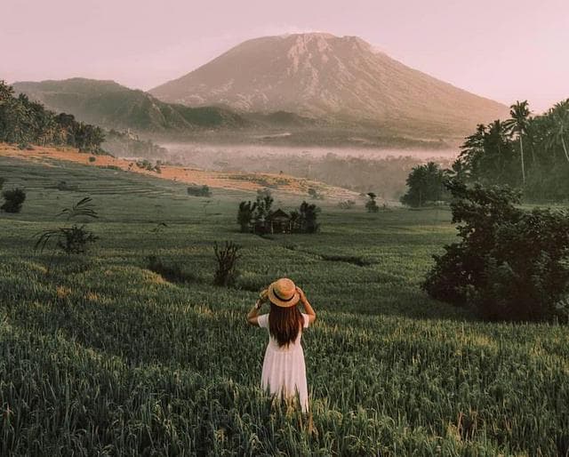
Yes. Clear mornings show the full cone from the rice fields of Sidemen, from Besakih temple and from the split gate at Lempuyang. Amed and Jemeluk on the east coast see it behind the bay at sunset. From the Batur sunrise trek, Agung stands on the skyline to the southeast. By late morning it is usually in cloud.
Nearby
Where to go after Mount Agung Trek.
Places close by that fit into the same trip, with realistic travel times.
35–45 min by car from Pasar Agung (27 km)
Besakih Temple
Bali’s mother temple on Agung’s southwest slope, and the start of the summit route.
Visitor guide35–50 min by car (20 km)
Sidemen rice valley
Terrace walks, weaving looms and the nearest quiet base for a night start.
35–45 min by car (24 km)
Tirta Gangga
The royal water garden of Karangasem, with koi ponds and stepping stones.
Visitor guide40–50 min by car (32 km)
Kerta Gosa
Klungkung’s old royal court, with painted ceilings of heaven and hell.
Visitor guide50–60 min by car (33 km)
Lempuyang Temple
The split gate that frames Agung from the east; arrive early for the line.
Visitor guide40–50 min by car (31 km)
Goa Lawah Temple
A sea temple built around a bat cave, on the coast road south of the mountain.
Visitor guide
More in Sidemen
Plan the rest of your time in Sidemen.


How we researched this
Sources and fact checks.
Prices, opening hours, show times and travel times in this Mount Agung Trek guide were checked against official sites, government tourism pages and recent reporting on 11 November 2026. Where sources disagreed, we give the official figure and say so. Rankings are our editorial judgment, set out in our editorial policy.
We re-check the guide at least every three months and whenever we hear about a change. Spotted something out of date? Tell us.
Show all 18 sources ↓Hide sources ↑
- magma.esdm.go.id/v1/gunung-api/tingkat-aktivitas
- magma.esdm.go.id/v1/gunung-api/laporan
- detik.com/bali/wisata/d-7727198/perhatian-pendaki-gunung-…
- bali.antaranews.com/berita/367010/pemprov-bali-larang-mendaki-gunun…
- bali.antaranews.com/berita/366286/basarnas-bali-temukan-jasad-warga…
- detik.com/bali/berita/d-6414412/bule-as-terjatuh-tewas-sa…
- bali.antaranews.com/berita/357623/pendakian-gunung-agung-ditutup-se…
- thebalisun.com
- bali.live/p/mount-agung-hikes-to-close-for-a-month-due-to…
- detik.com/bali/berita/d-7587420/pengempon-pura-pasar-agun…
- thebalisun.com/bali-axes-ban-on-tourist-access-to-sacred-mount…
- indonesia.travel/id-en/destination/bali-nusa-tenggara/bali/gunun…
- en.wikipedia.org/wiki/Mount_Agung
- gunungbagging.com/agung
- theworldtravelguy.com/mount-agung-hike-in-bali-trekking-the-gunung-ag…
- darmabalitours.blogspot.com/2026/03/mount-agung-trekking-tour-conquer-balis…
- openstreetmap.org
- router.project-osrm.org